Featured pilot
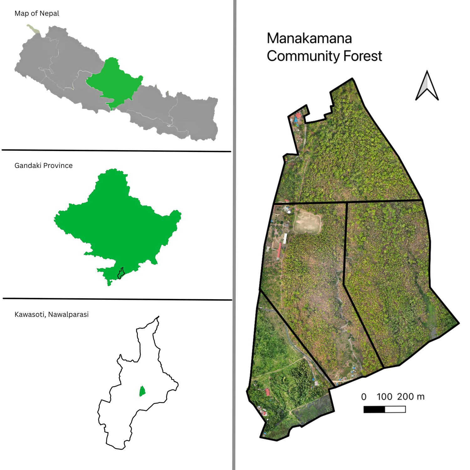
Shree Manakamana Community Forest
Kawasoti, Nawalpur · Gandaki Province · UAV + DeepForest
We flew a low-altitude UAV survey over the community forest, built a centimetre-scale orthomosaic, and ran a DeepForest tree-crown model to delineate and measure every individual tree — producing a stem map, crown-area distribution and stand-structure statistics the CFUG can use directly in its operational plan.
6,543
trees mapped
4.4 cm
ground sample distance
0.75
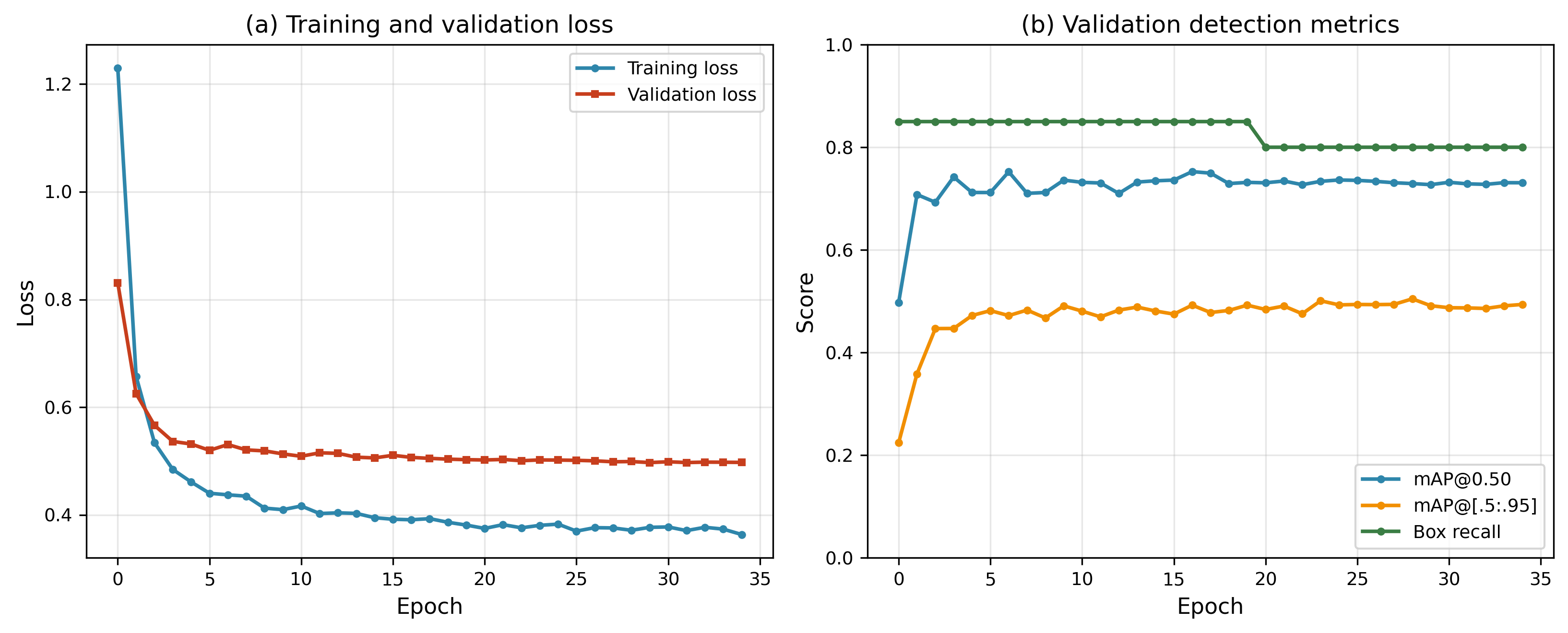
mAP @ 0.50
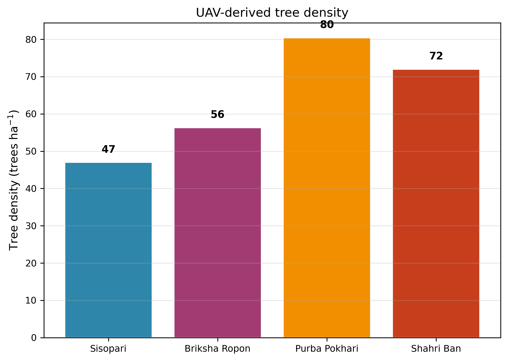
Crown density
Stems-per-hectare surface across the forest blocks.
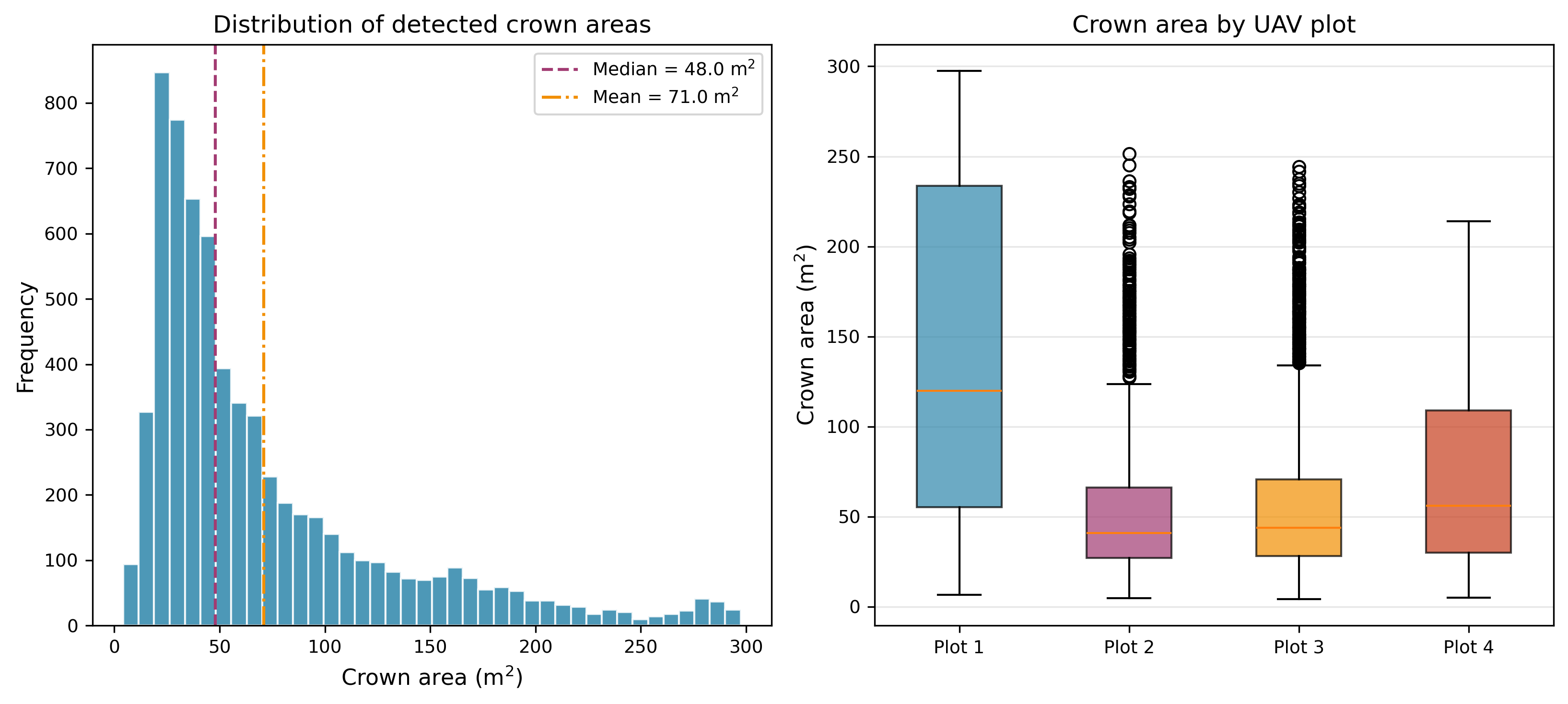
Crown-area distribution
Per-tree crown areas from the detected polygons.
Model performance
DeepForest training curve and validation accuracy.